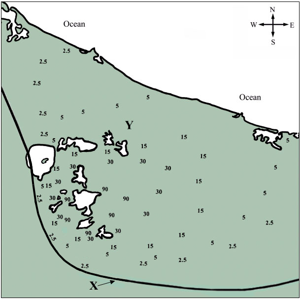
This task is about interpreting a map and identifying issues about volcanic ash.
Below is a map of an area affected by ash fall from a volcanic eruption.
The numbers, e.g., 15, represent the limit of ash for that depth in centimetres (cm).

| a) |
Draw curved lines to join all the numbers which are the same, This will show the limits of ash for the five different depths.
(NOTE: You can draw lines through the lakes, but do not draw lines in the ocean. Draw lines to the coast or the edge of the map where appropriate).
|
|
| b) |
At point Y on the map, what would be the approximate depth of ash? __________ cm.
|
|
| c) |
What description about ash fall should be given to the line labelled X?
|
|
| d) | i) |
Draw a letter V on the map to show the point where the erupting volcano probably was located.
|
| ii) |
What evidence did you use to decide on the location of this volcano?
|
|
|
e)
|
From which direction was the wind probably blowing when this eruption occurred?
____________________
|
|
| f) |
Explain three major problems this ash could cause if there were towns nearby.
|
|
| 1. |
|
|
| 2. |
|
|
| 3. |
|
|