Roads and earthquakes

Roads and earthquakes

Auto-markingPencil and paperOnline interactive
Overview
Using this Resource
Connecting to the Curriculum
Marking Student Responses
Working with Students
Further Resources
This task is about diagrams that show what could happen to a road in an earthquake.
Here is a drawing of a road seen from above.

birds eye view of a road
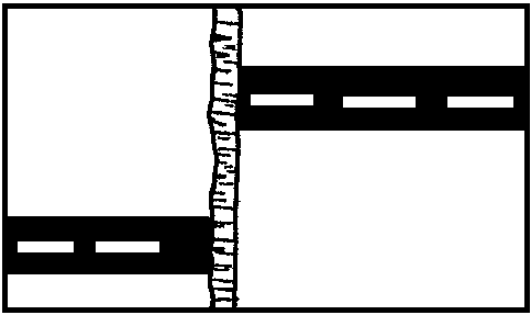
These two diagrams show how the piece of land on which the road is built could be affected by earthquakes.
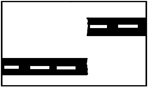
 
birds eye view of a road after an earthquake
Diagram A
birds eye view of a road after an earthquake
Diagram B

Question

a) Diagram A below shows how the land where a road is built could be affected by earthquakes.
 
birds eye view of a road after an earthquake
Which of these cross sections (1, 2, or 3) would show diagram A?
    • side angle view of a road after an earthquake

    • side angle view of a road after an earthquake

    • side angle view of a road after an earthquake

Question

b) Diagram B shows how the land where a road is built could be affected by earthquakes.
 
birds eye view of a road after an earthquake
Which of these cross sections (1, 2, or 3) would show diagram A?
    • side angle view of a road after an earthquake

    • side angle view of a road after an earthquake

    • side angle view of a road after an earthquake

Task administration: 
This task can be completed with pencil and paper or online.
Level:
4
Keywords: 
Description of task: 
Students answer questions about how a road moves after an earthquake.
Curriculum Links: 
Science capabilities
The capabilities focus is brought about by the conversations you have and the questions you ask.
 
Capability: Interpret representations
This resource provides opportunities to discuss what the diagrams show about the movement of the land as a result of an earthquake.
Science capabilities: 
Answers/responses: 
  Y8 (05/1999)
a) moderate
b) moderate
Diagnostic and formative information: 
   Common error
a) [and b)]
23% [24%] of students chose cross section 2